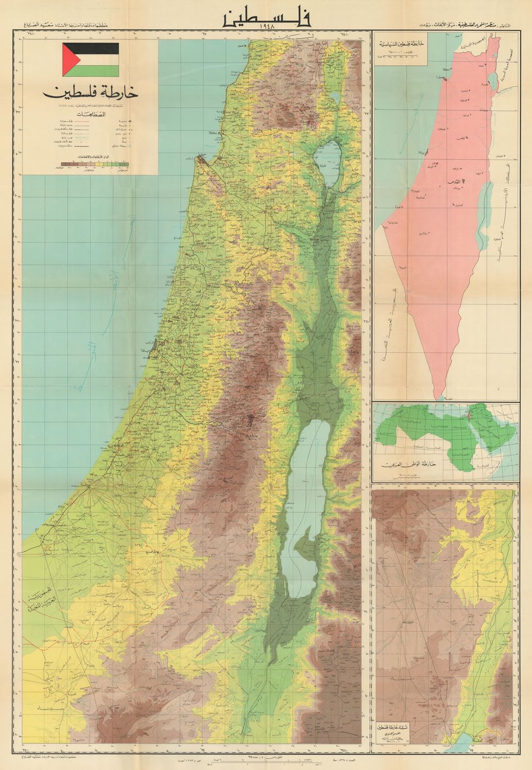
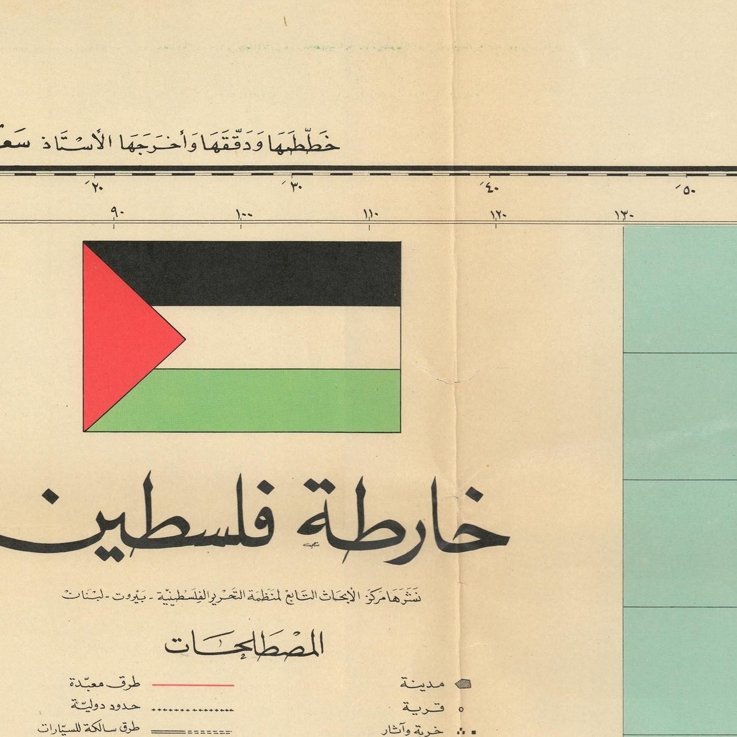
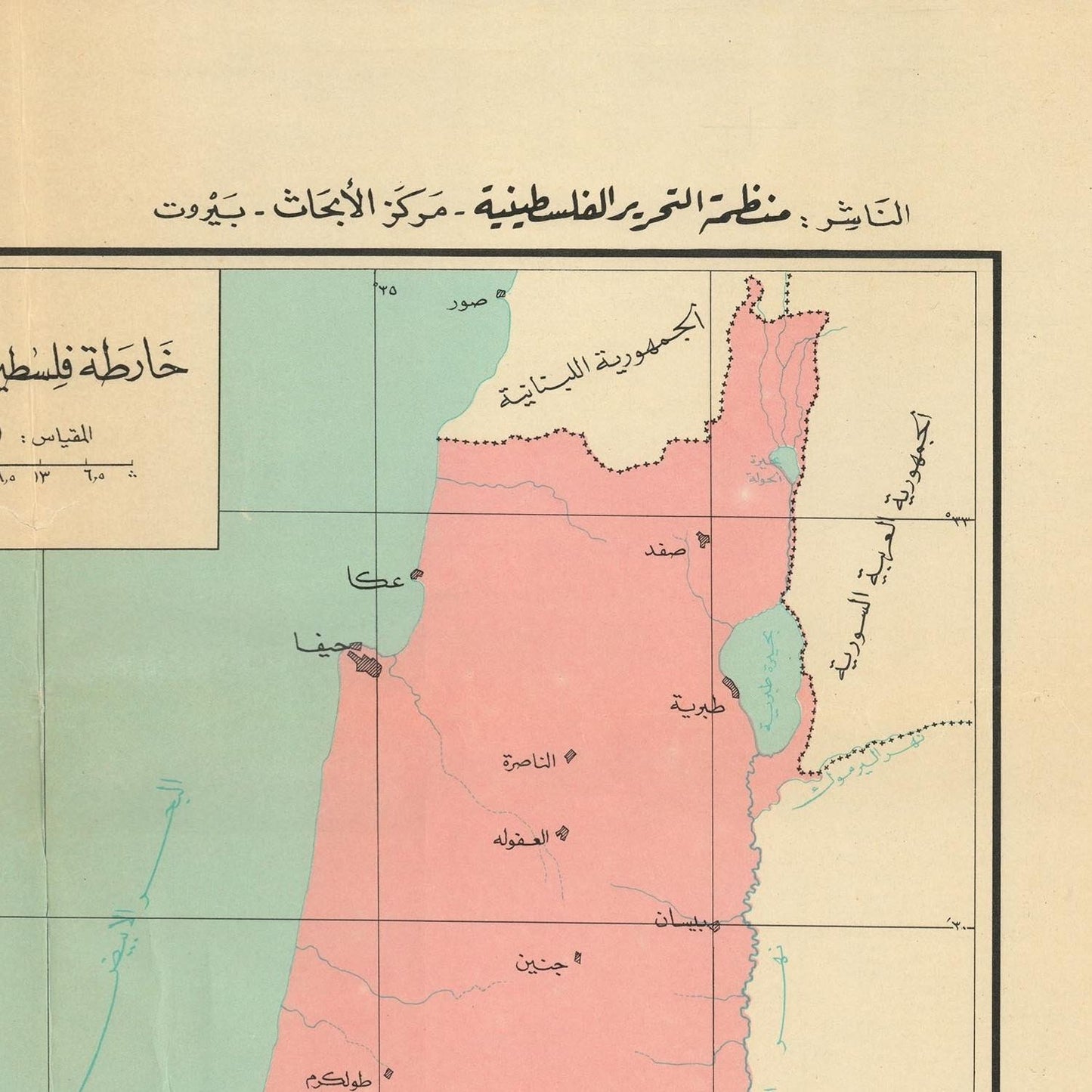
The Sabbagh PLO Research Center Wall Map of Palestine in 1948 is a significant historical document that offers a detailed and poignant representation of Palestine at a critical juncture in its history. Created to reflect the geopolitical landscape of 1948, this map is an essential resource for understanding the territorial, social, and political context of Palestine during the mid-20th century.
The year 1948 is a pivotal one in Palestinian history, marked by the establishment of the state of Israel and the resulting Arab-Israeli conflict. This period, often referred to as the Nakba (catastrophe) by Palestinians, saw significant displacement and upheaval. The Sabbagh PLO Research Center Wall Map was created to document and preserve the memory of Palestine's geographical and demographic landscape before these transformative events.
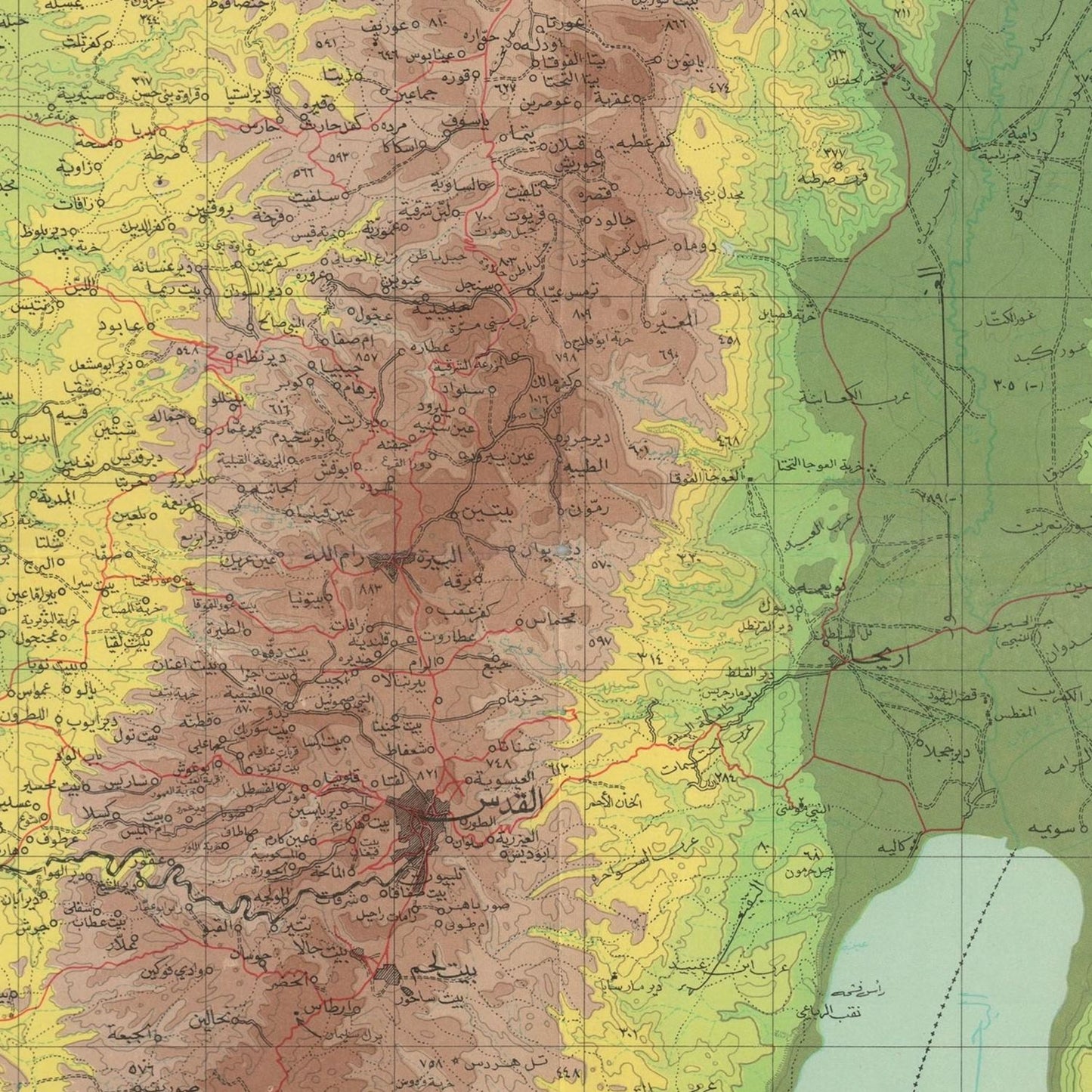
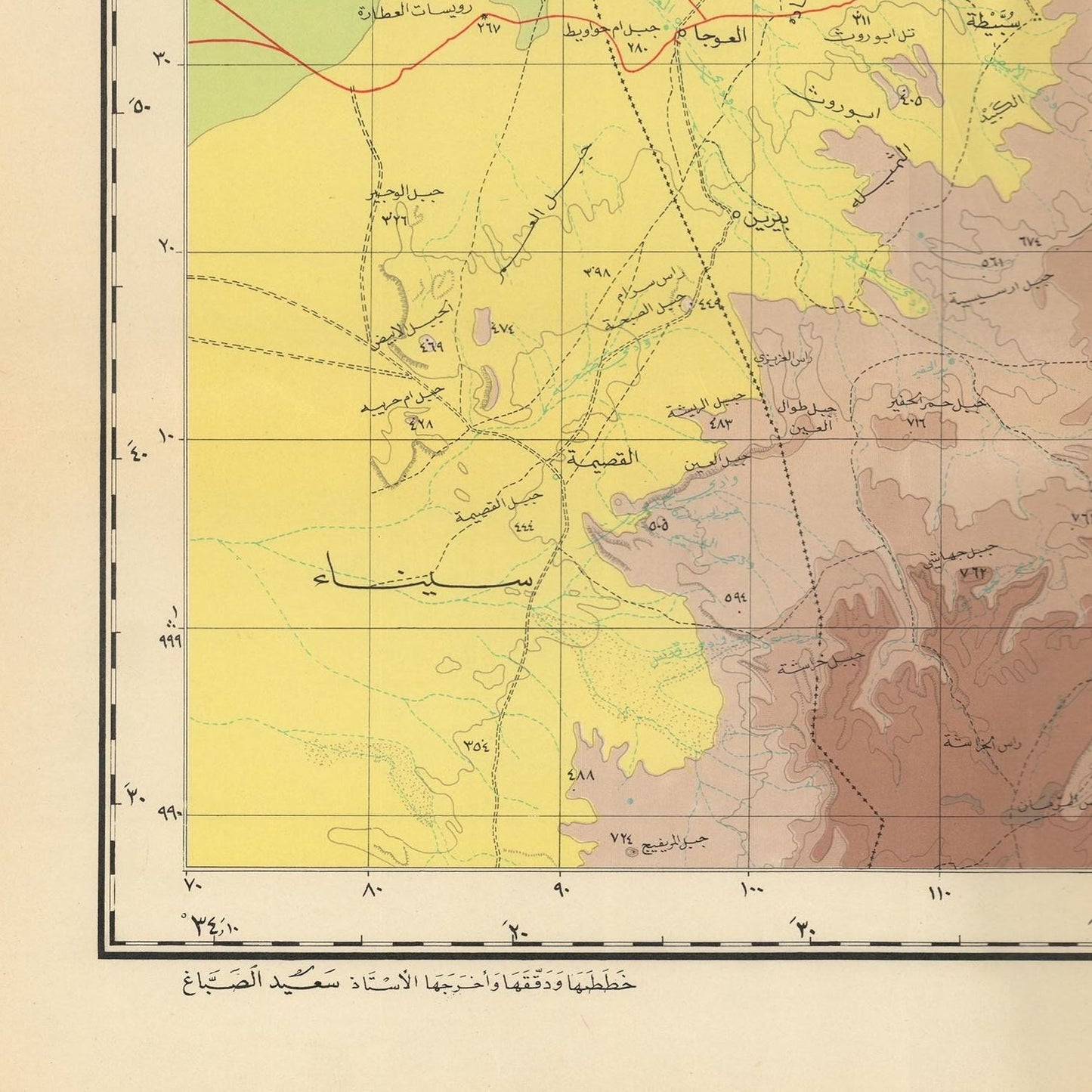
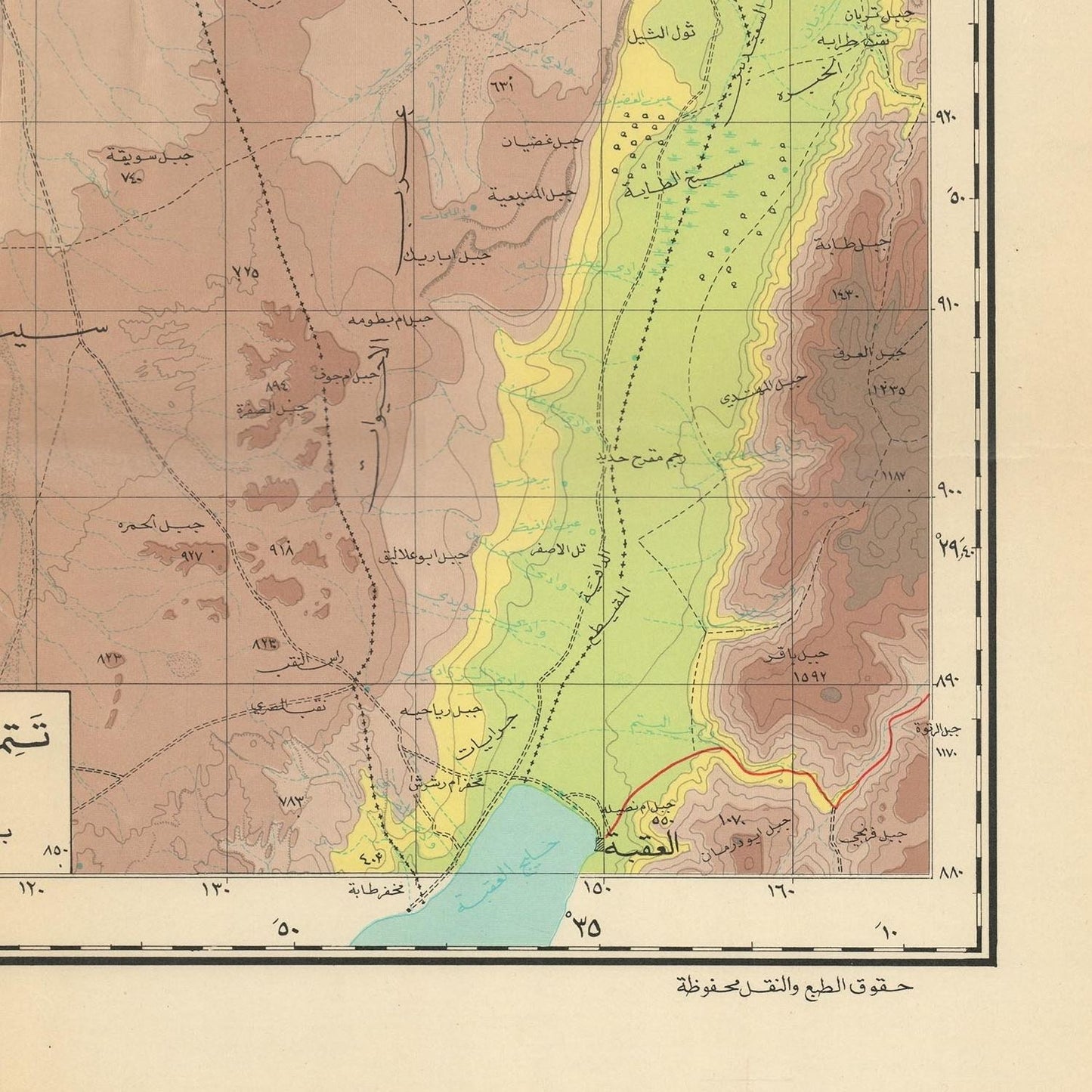
The map meticulously details the geographical features of Palestine as they existed in 1948. It includes major cities, towns, villages, and important landmarks, providing a comprehensive overview of the region’s urban and rural settlements. Prominent cities such as Jerusalem, Haifa, Jaffa, and Gaza are highlighted, reflecting their significance in the historical and cultural landscape of Palestine.
Natural features such as rivers, mountains, and the coastline of the Mediterranean Sea are also clearly depicted, emphasizing the region’s diverse topography. The map illustrates the fertile plains, rugged highlands, and the strategic importance of water bodies like the Jordan River and the Dead Sea.
A crucial aspect of the Sabbagh PLO Research Center Wall Map is its depiction of political boundaries and administrative divisions as they were recognized in 1948. This includes the delineation of districts, sub-districts, and municipalities, providing a detailed understanding of the administrative structure of Palestine at that time. The map serves as a visual record of the territorial claims and boundaries that were contested and redrawn in the ensuing conflict.
The map also provides valuable demographic information, indicating the distribution of the Palestinian population across various regions. It marks the locations of Palestinian Arab and Jewish communities, reflecting the diverse and multi-ethnic composition of the population in 1948. This demographic data is essential for understanding the social fabric of Palestine and the impact of subsequent events on its population.
**Cultural and Historical Landmarks**
In addition to its geographical and political details, the map highlights significant cultural and historical landmarks. Religious sites, educational institutions, and cultural centers are marked, underscoring the rich heritage and historical significance of Palestine. This includes notable locations such as the Al-Aqsa Mosque, the Church of the Nativity, and various ancient sites that are integral to the region’s cultural identity.
The Sabbagh PLO Research Center Wall Map is not only a historical document but also an important educational tool. It provides researchers, historians, and educators with a detailed visual representation of Palestine as it existed in 1948, facilitating a deeper understanding of the region’s history and the complex factors that have shaped its present.
This map holds significant value for the Palestinian community and for anyone interested in Middle Eastern history. It serves as a poignant reminder of a critical period in Palestinian history, preserving the memory of a landscape and society that experienced profound change. The map’s detailed representation of Palestine in 1948 continues to be a crucial reference for discussions on territorial disputes, historical narratives, and the quest for understanding the past.
In summary, the Sabbagh PLO Research Center Wall Map of Palestine in 1948 is a vital historical artifact that provides a comprehensive and detailed depiction of Palestine at a critical moment in its history. Its geographical, political, and demographic details offer invaluable insights into the region’s landscape before the significant events of 1948. This map remains an essential resource for historians, researchers, and educators seeking to understand and preserve the memory of Palestine’s historical and cultural heritage.