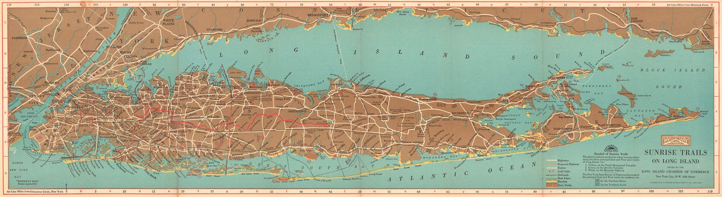
The 1927 Map of Long Island, created by Redfield-Kendrick-Odell, is a significant cartographic artifact that provides a detailed and comprehensive depiction of Long Island during a period of rapid development and change. This meticulously crafted map offers valuable insights into the geography, infrastructure, and socio-economic landscape of Long Island in the late 1920s, making it an indispensable resource for historians, researchers, and enthusiasts of cartographic history.
The 1920s were a transformative decade for Long Island, characterized by suburban expansion, the rise of automobile travel, and significant infrastructural developments. The map by Redfield-Kendrick-Odell captures this dynamic period, documenting the island's transition from a largely rural area to a burgeoning suburban region. The map's creation in 1927 coincides with a time when Long Island was experiencing increased residential development, improved transportation networks, and growing economic opportunities.
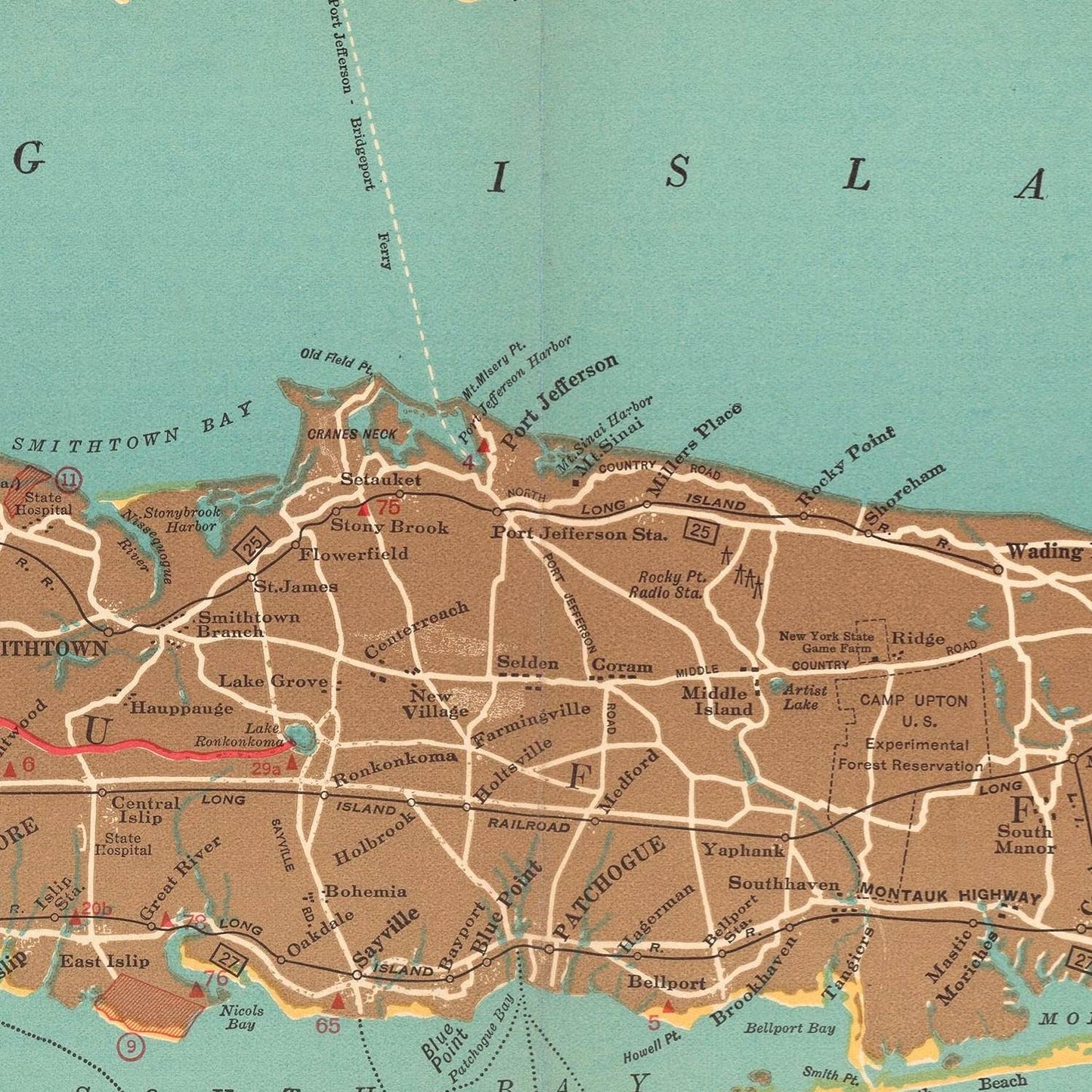
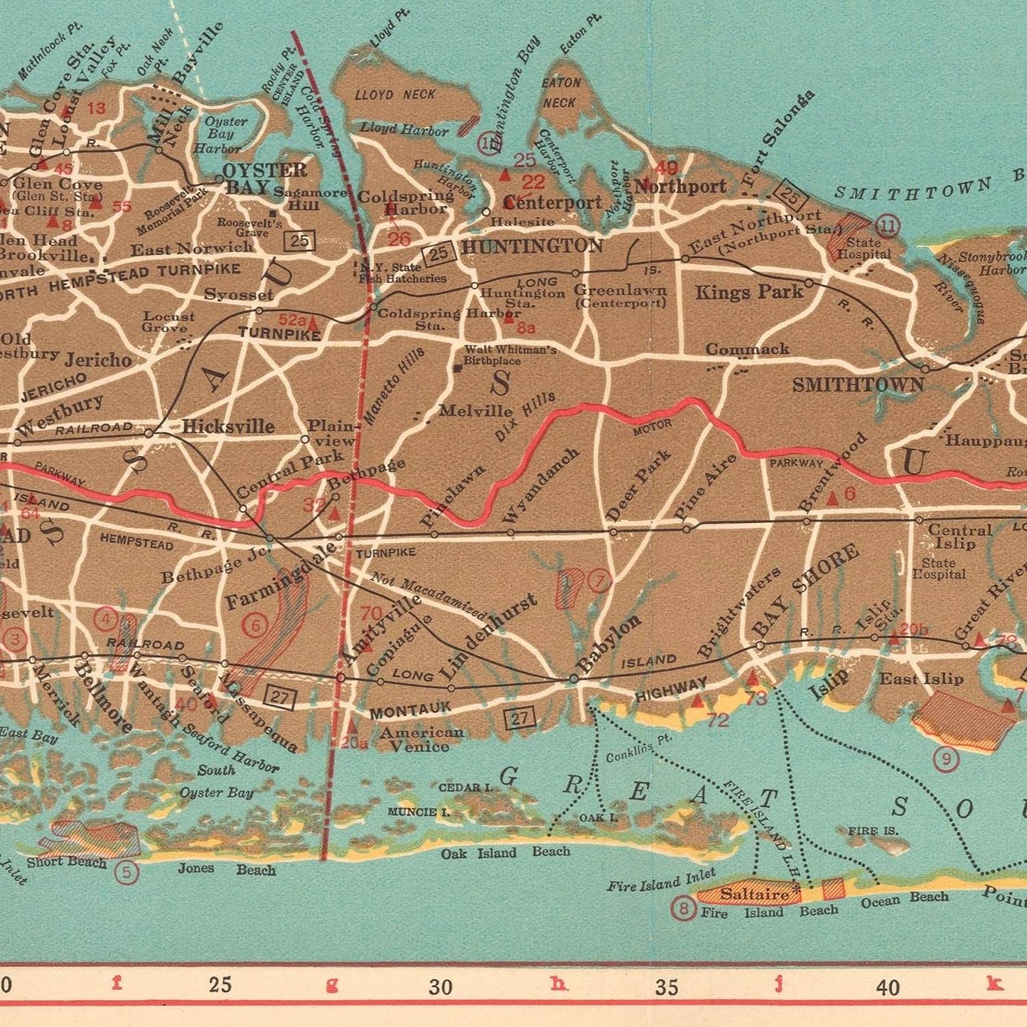
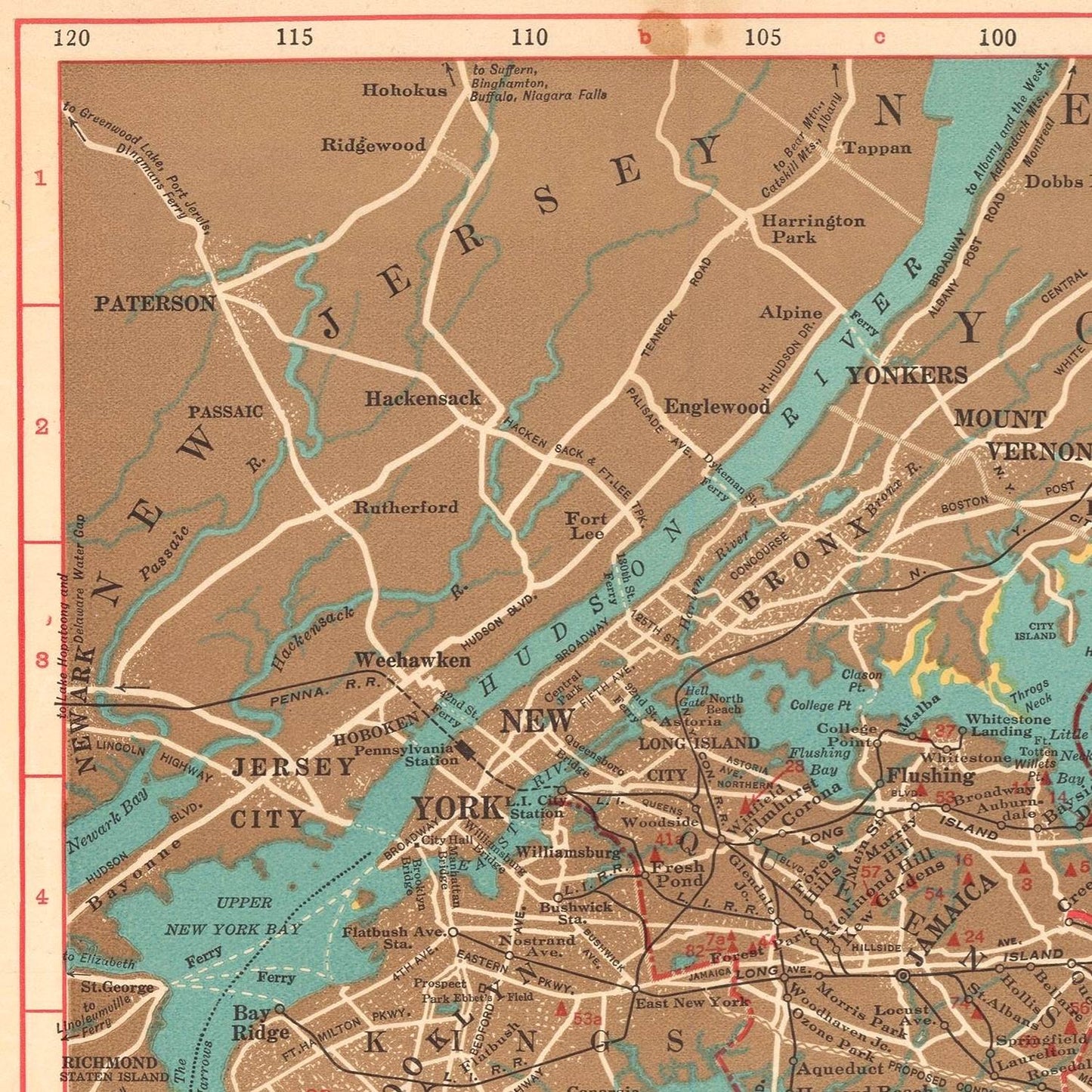
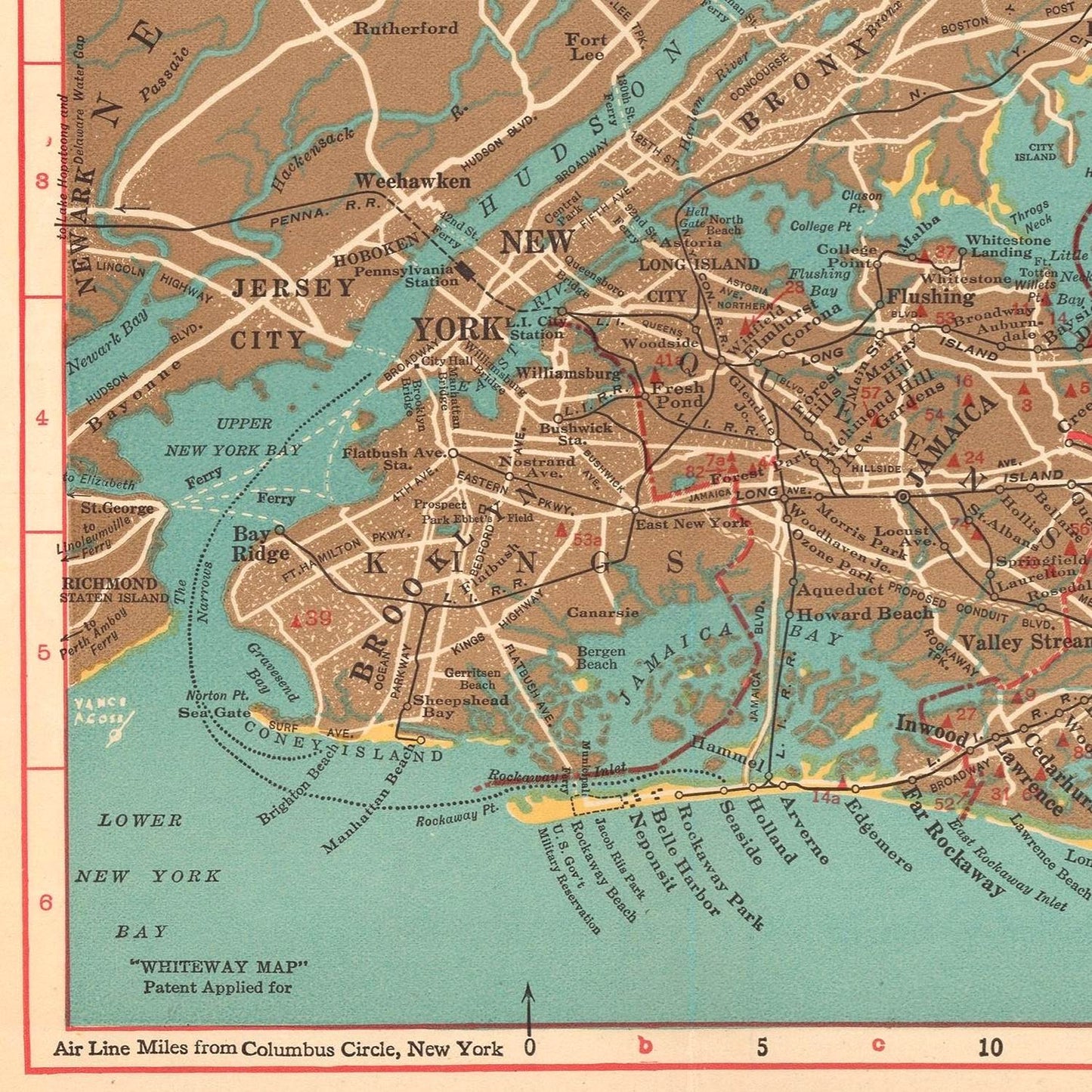
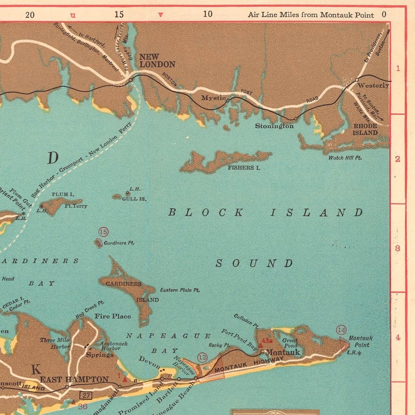
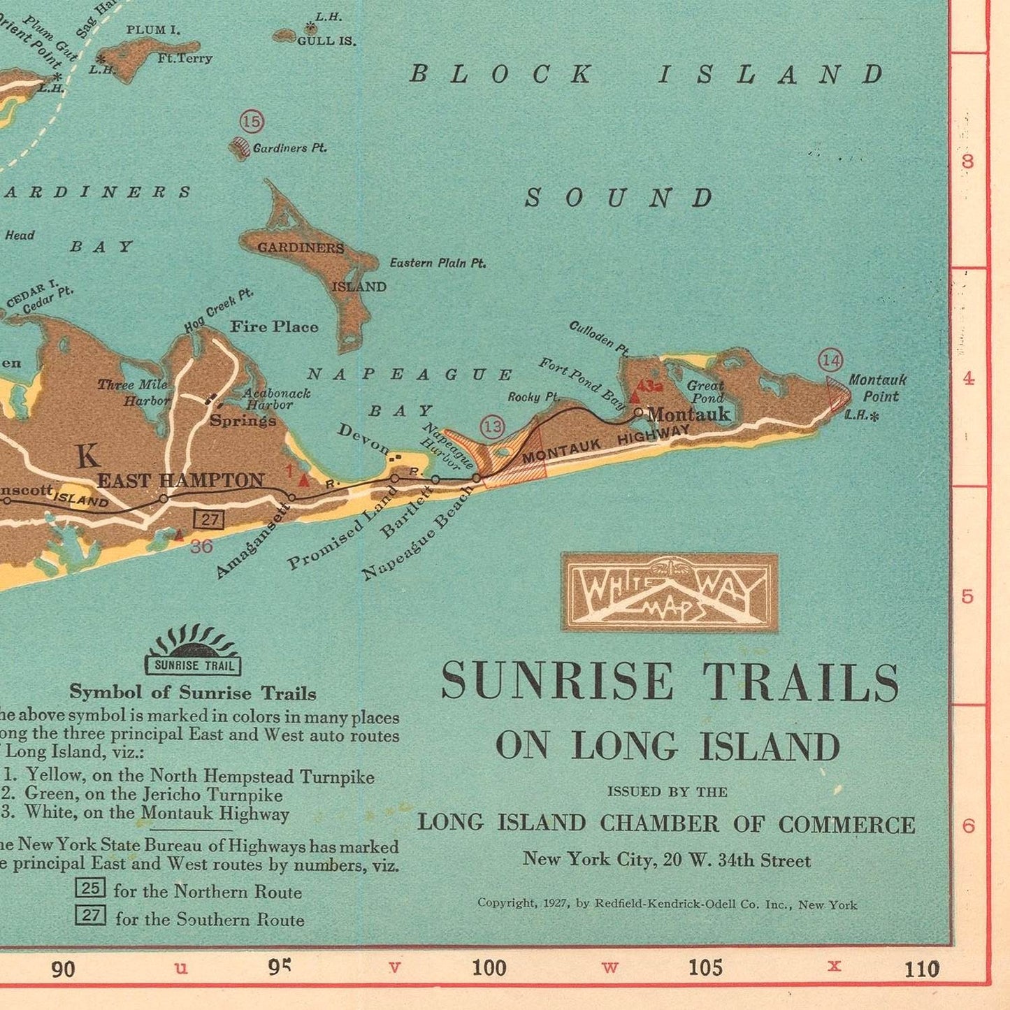
The 1927 map provides an extensive overview of Long Island's geographical features, including its coastline, bays, and estuaries. It meticulously details the island’s towns, villages, and hamlets, offering a clear representation of the region’s urban and rural areas. Major cities such as Brooklyn, Queens, and various towns in Nassau and Suffolk counties are prominently marked, reflecting the population centers of the time.
One of the most notable aspects of the map is its depiction of transportation infrastructure. The map highlights major roads, highways, and railways, which were crucial for the mobility and economic development of Long Island. Key routes such as the Long Island Rail Road, major highways, and emerging road networks are clearly delineated, showcasing the connectivity and accessibility of different parts of the island.
The map also provides insights into the residential and commercial development patterns of the 1920s. It marks significant landmarks, estates, parks, and recreational areas, indicating the growing appeal of Long Island as a residential and leisure destination. The map's detail extends to notable commercial establishments and industrial sites, reflecting the diverse economic activities that contributed to the region's growth.
Redfield-Kendrick-Odell’s map of Long Island is not only a practical tool but also an example of artistic and technical excellence in cartography. The map is characterized by its precise and clear rendering of geographical features, careful labeling, and aesthetically pleasing design. The use of color, shading, and fine lines enhances the readability and visual appeal of the map, making it both an informative and attractive piece of cartographic art.
In summary, the 1927 Map of Long Island by Redfield-Kendrick-Odell is a cartographic masterpiece that captures the essence of Long Island during a period of significant change. Its detailed depiction of geographical features, infrastructure, and development patterns provides a comprehensive overview of the region in the late 1920s. This map continues to be a valuable resource for understanding the history and growth of Long Island, reflecting the artistic and technical prowess of its creators.