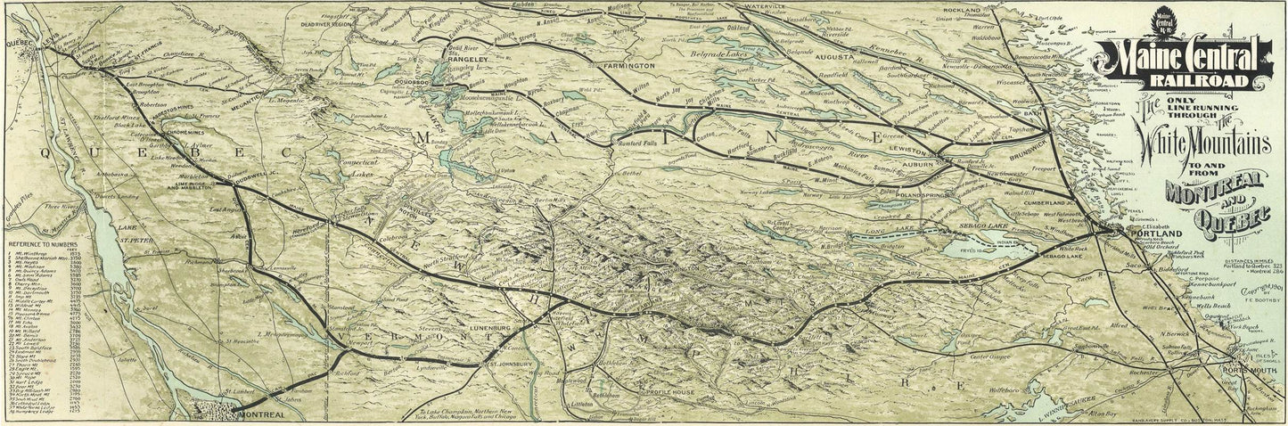
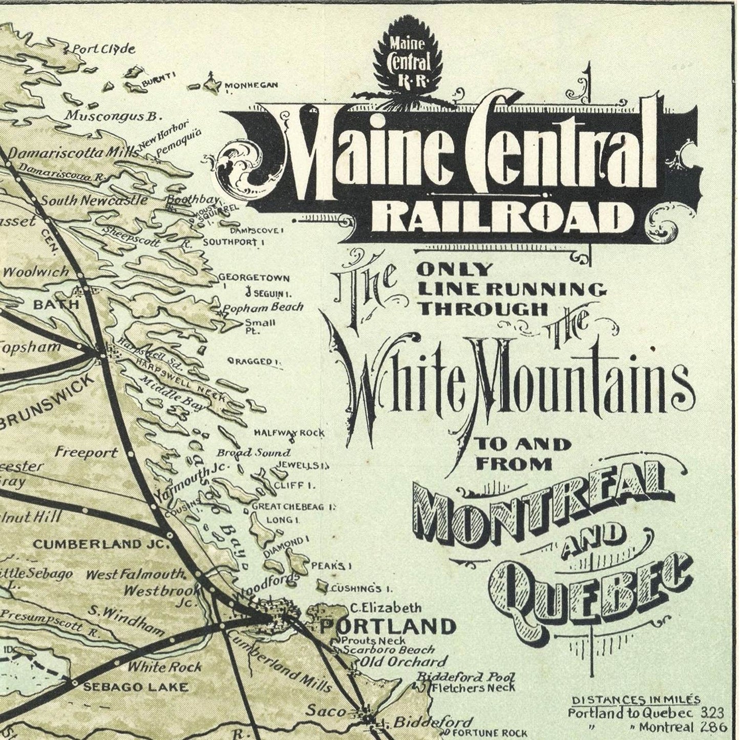
The 1901 map created by Boothby Rand Avery offers a detailed and comprehensive view of Northern New England and Quebec, capturing the region's geography, infrastructure, and cultural landmarks during the turn of the 20th century. This meticulously crafted map is a testament to Avery's cartographic skill and provides valuable insights into the historical context and development of this significant area.
The early 1900s were a period of rapid development and change in Northern New England and Quebec. The Industrial Revolution had brought significant advancements in transportation and infrastructure, which are meticulously documented in Avery's map. This era also saw increased cross-border interactions and economic activities between the United States and Canada, particularly in regions like Northern New England and Quebec, which share cultural and geographical ties.
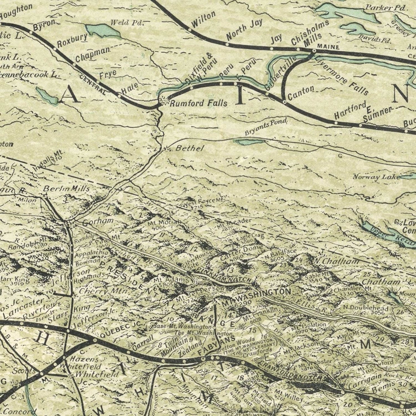
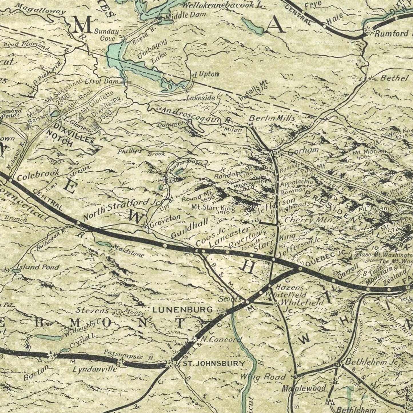
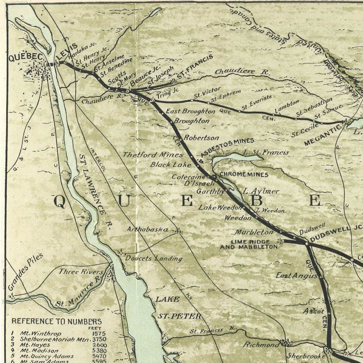
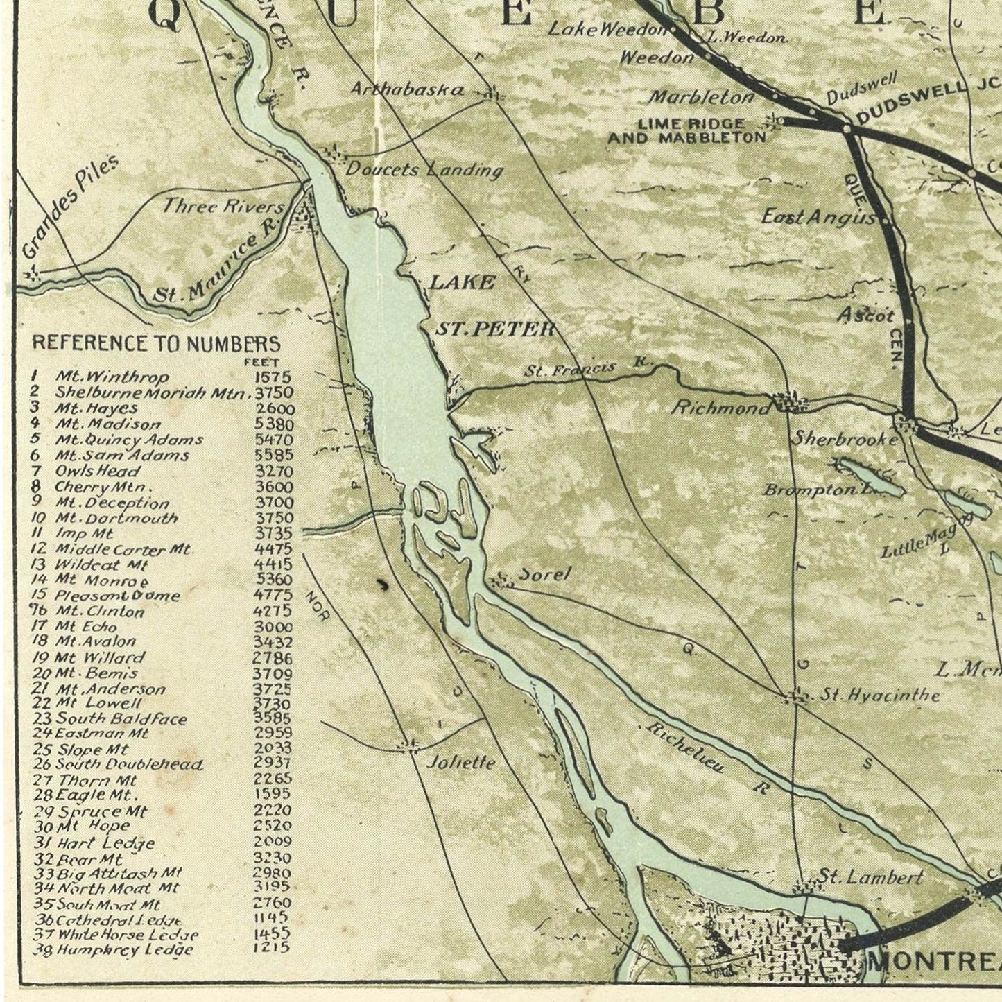
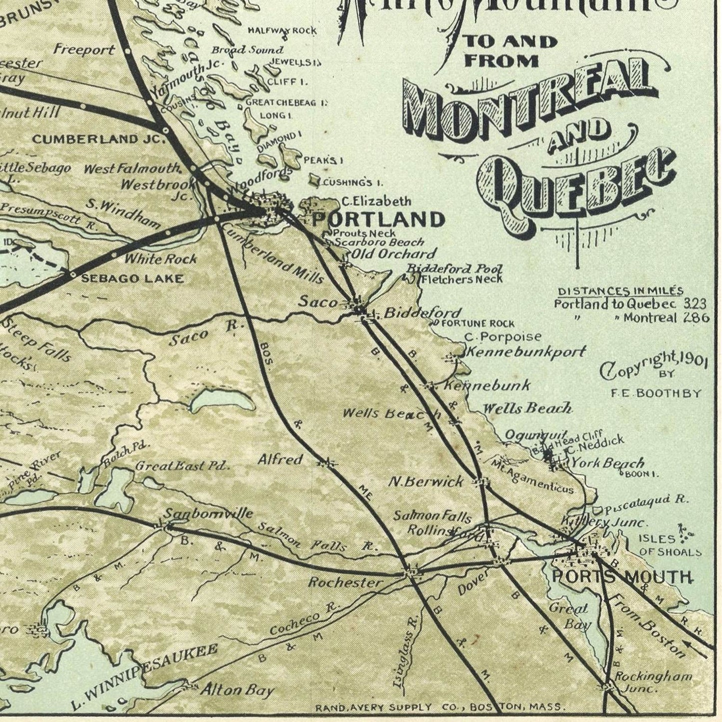
Avery’s 1901 map meticulously details the geographical features of Northern New England, encompassing parts of Maine, New Hampshire, and Vermont, as well as Quebec in Canada. The map highlights the region’s varied topography, including mountain ranges, rivers, lakes, and coastlines. Prominent geographical landmarks such as the White Mountains, Lake Champlain, and the St. Lawrence River are clearly depicted, emphasizing their importance in the region's natural landscape.
The map also provides a comprehensive overview of the infrastructure developments of the time. It highlights major railroads, which were crucial for transportation and economic growth, connecting remote areas with larger cities and facilitating trade and travel. The network of railroads, including the Central Vermont Railway and the Grand Trunk Railway, is meticulously plotted, showcasing the region's connectivity.
Avery’s map offers detailed representations of significant cities and towns in Northern New England and Quebec. It marks important urban centers such as Portland, Burlington, and Quebec City, each depicted with careful attention to detail. These urban areas are shown with their street layouts, major buildings, and points of interest, reflecting their economic and cultural significance.
Smaller towns and rural communities are also included, providing a comprehensive view of the region’s settlement patterns. This aspect of the map is particularly valuable for understanding the distribution of population and the development of smaller communities during this period.
The 1901 map by Boothby Rand Avery goes beyond geographical and infrastructural details to include significant economic and cultural landmarks. Industrial sites, such as mills and factories, are marked, reflecting the region's industrial activity. Agricultural areas and significant farming communities are also highlighted, emphasizing the importance of agriculture in the regional economy.
Cultural landmarks, including universities, historical sites, and recreational areas, are noted, providing insights into the cultural fabric of the region. The inclusion of these landmarks illustrates the diverse economic and cultural activities that characterized Northern New England and Quebec at the turn of the century.
In summary, the 1901 Boothby Rand Avery View of Northern New England and Quebec is a cartographic masterpiece that captures the essence of the region during a pivotal era. Its detailed depiction of geographical features, infrastructure, and cultural landmarks provides a comprehensive overview of the region's history and development. This map continues to be a valuable resource for understanding the heritage and evolution of Northern New England and Quebec, reflecting Avery’s expertise and meticulous craftsmanship.